


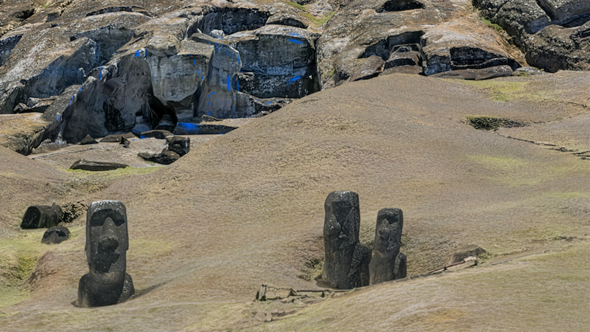
Rapa Nui, widely known as Easter Island, has taken a significant step towards accessibility with the launch of a high-resolution 3D model of the Rano Raraku quarry. This initiative, driven by a team of geographers and researchers from Binghamton University and the State University of New York, enables virtual exploration of one of the island’s most iconic sites, which is typically off-limits to visitors due to safety concerns.
Located in the South Pacific Ocean, Easter Island is the most isolated inhabited island in the world, home to around 6,000 residents. The island, covering approximately 63.2 square miles, attracts around 100,000 tourists annually who come to see the famous moai statues. These monumental stone heads, some standing over 13 feet tall, are a testament to the island’s rich cultural heritage.
As the number of visitors increases, the island faces challenges related to overtourism. To mitigate the impact, flights to Rapa Nui are limited, particularly during the busy season from December to March. This limitation has made it difficult for many to experience the island in person. The newly developed 3D model offers a solution, allowing anyone to explore the Rano Raraku quarry from the comfort of their home.
Innovative Technology Brings Rano Raraku to Life
The 3D model of Rano Raraku showcases nearly 1,000 meticulously rendered moai statues. It was created using advanced Structure-from-Motion photogrammetry techniques, utilizing 11,686 aerial images captured via drone. This technology reveals the intricate spatial organization of production activities that occurred in the quarry and provides a comprehensive digital documentation of the area.
Carl Lipo, a professor of anthropology at Binghamton University and the lead author of a forthcoming paper on the model published in PLOS One, expressed enthusiasm about the project’s potential. “You can see things that you couldn’t actually see on the ground,” he stated. The model allows users to view aspects of the quarry that are inaccessible to visitors, enhancing the understanding of this significant archaeological site.
Lipo emphasized the importance of documenting Rano Raraku in a way that is both thorough and shareable. He noted that this digital exploration could broaden public engagement with the island’s history and culture. “We’re documenting something that really has needed to be documented,” he said, highlighting the model’s role in preserving and sharing Rapa Nui’s heritage.
Future Implications for Tourism and Research
The launch of the 3D model not only serves researchers but also opens new avenues for tourism. By providing a virtual experience, the model could help alleviate some pressure on the physical site while still allowing people to connect with Rapa Nui’s history. Lipo described the quarry as “the archaeological Disneyland,” a metaphor that emphasizes its significance and allure.
As the world becomes increasingly digital, such innovations can change how we engage with historical sites. Rano Raraku’s 3D model is a prime example of how technology can bridge the gap between preservation and accessibility, ensuring that even the most remote locations can be appreciated by a global audience.
In summary, the new 3D map of Rano Raraku not only allows people to explore Easter Island’s hidden treasures but also highlights the importance of preserving cultural heritage in an era of increasing tourism. This initiative stands as a model for similar projects worldwide, showcasing the potential of technology to enhance our understanding of the past.