


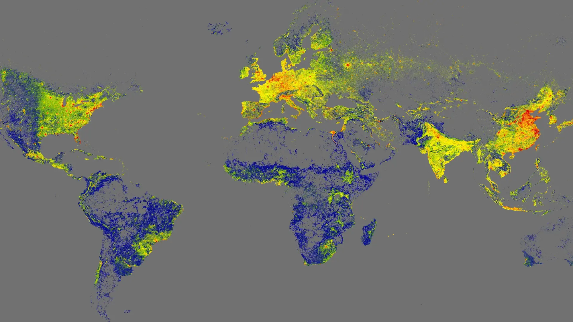
Researchers at the Technical University of Munich in Germany have achieved a significant milestone in the field of cartography with the launch of the GlobalBuildingAtlas, a comprehensive 3D mapping model that details every building worldwide. This innovative project, which includes over 2.75 billion buildings, aims to enhance urban analysis, infrastructure planning, and social assessments on a global scale.
The GlobalBuildingAtlas is not merely an exercise in mapping; it serves as a critical tool for understanding urbanization and socio-economic conditions. According to Xiaoxiang Zhu, the lead researcher, “3D building information provides a much more accurate picture of urbanization and poverty than traditional 2D maps.” By representing both the footprint and volume of structures, the atlas allows for a deeper insight into living conditions across different regions.
New Measurement Tool Enhances Urban Analysis
In addition to the mapping model, Zhu’s team has developed a groundbreaking measurement tool that calculates building volume per capita. This metric assesses the total building mass in relation to the population of an area, providing valuable insights into housing and infrastructure disparities. Zhu emphasizes that “this indicator supports sustainable urban development and helps cities become more inclusive and resilient.”
The level of detail in GlobalBuildingAtlas is unmatched, with approximately 97 percent of the 3D structures classified as Level of Detail 1 (LoD 1). This classification ensures that the basic shape and height of buildings are accurately represented, making the data usable for various computer modeling projects. The atlas boasts a resolution of 9.8 by 9.8 feet, which is 30 times more detailed than similar mapping initiatives.
Open Access and Future Updates
Compiled using data available as of 2019, the GlobalBuildingAtlas is designed as an open-access resource, allowing for continuous updates and improvements. The open-source nature of the project means that it could soon reflect the most current data, further enhancing its utility for researchers and urban planners alike.
As cities face increasing challenges related to urban growth and sustainability, tools like the GlobalBuildingAtlas will play a crucial role in driving informed decisions. The project represents a significant advancement in our ability to visualize and analyze the built environment, providing an engaging and detailed resource for anyone interested in exploring the world’s architectural landscape.