


UPDATE: The National Weather Service (NWS) in Mobile has issued an urgent winter weather forecast indicating potential snow for Saturday night, December 2, 2023. As of 4 p.m. Thursday, two scenarios are being monitored, with significant implications for local residents and travelers.
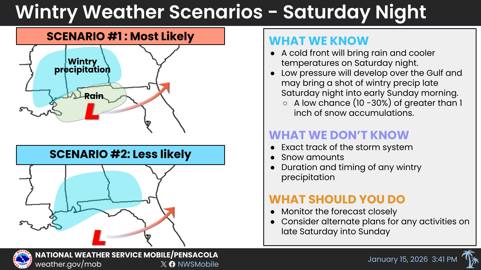
According to NWS projections, the most likely outcome involves a low-pressure system failing to form over the northern Gulf. In this scenario, light rain will begin Saturday evening, transitioning to a wintry mix and possible snow overnight. Accumulations are expected to remain light, with most areas receiving less than 0.5 inch of snow. However, should this scenario materialize, a reasonable worst-case estimate could see accumulations rise to 0.75-1 inch.
Alternatively, scenario two, while considered less likely, suggests that low pressure may form over the northern Gulf and track further south. This could result in a longer duration of wintry precipitation, beginning with light rain on Saturday evening before shifting to a wintry mix and snow overnight. In this case, light snow accumulations are expected, with the possibility of brief heavy snow, particularly in eastern areas of I-65. Under this scenario, the most likely snow accumulation would be between 0.75-1 inch, with a worst-case scenario reaching between 1-2 inches.
The NWS urges residents to stay alert, as updates will be provided Friday morning at 7 a.m.. Local emergency management agencies have been notified to prepare for potential impacts, emphasizing the importance of being informed and ready for changing weather conditions.
As this situation develops, individuals in the affected areas should monitor local forecasts and prepare for possible travel disruptions. The community’s safety is paramount, and staying informed will be critical as the winter weather approaches.
Stay tuned for further updates as the NWS continues to assess the situation and provide timely information to the public.