


URGENT UPDATE: Severe storms are rapidly approaching Michigan, with the potential to unleash wind gusts of up to 60 mph. Storms are already moving across the northern tip of the Lower Peninsula and the eastern Upper Peninsula, while another severe weather system is making its way across Lake Michigan toward West Michigan.
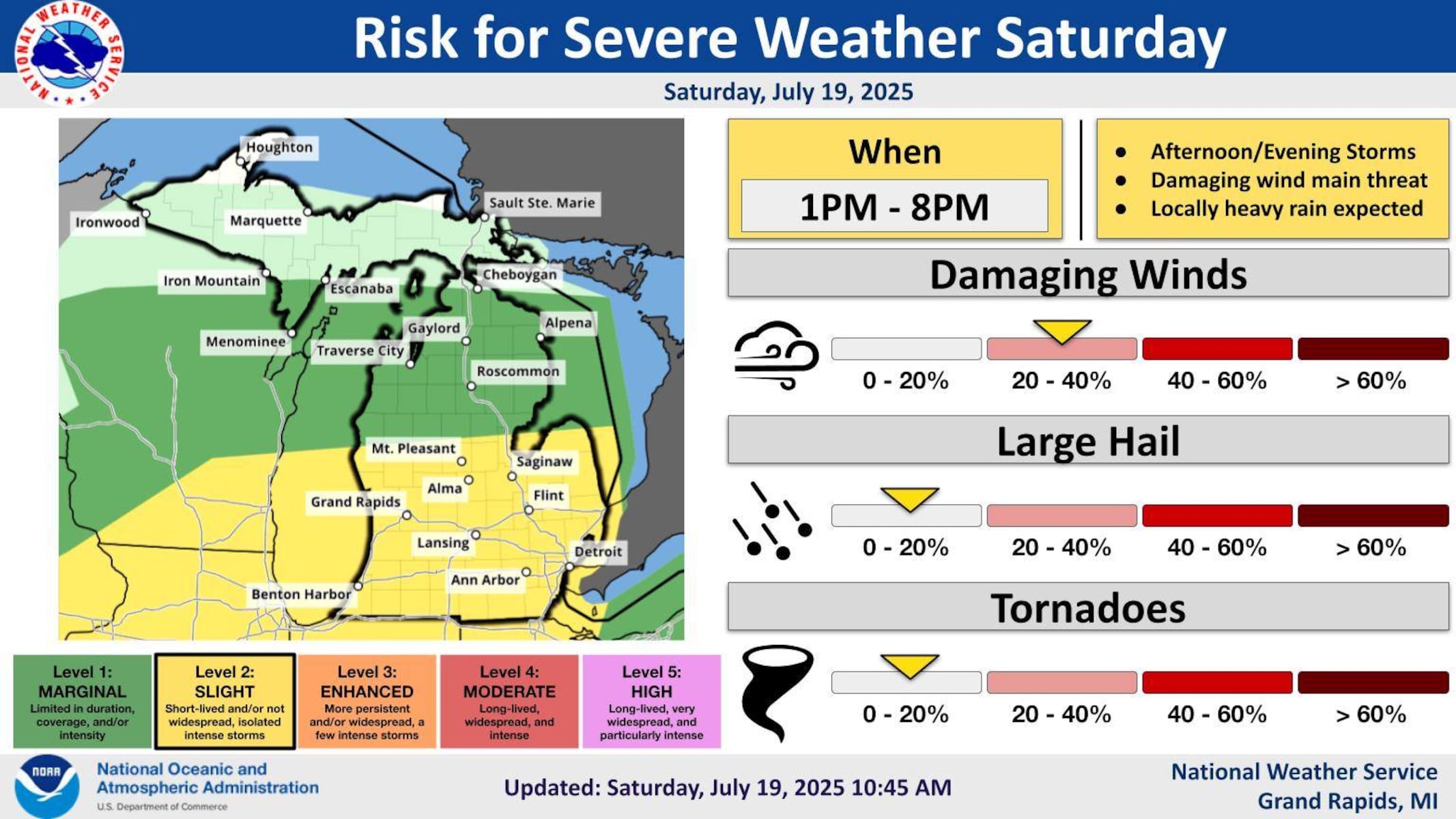
According to the National Weather Service (NWS), the primary threat from these storms will be damaging winds. As these storms develop this afternoon, residents are urged to stay alert. “A threat for severe weather exists today,” NWS meteorologists in Grand Rapids confirmed.
The latest forecasts indicate that storms will begin developing over Lake Michigan during the midday hours, with expected arrival in southwest Lower Michigan between 1 p.m. and 8 p.m.. The NWS highlights that while conditions are favorable for severe thunderstorms, it is “not a slam dunk” whether they will fully materialize.
Residents can expect a mix of weather; some areas may only see brief showers, while others could face heavy rainfall that may lead to localized flooding. The NWS warns of strong winds reaching between 50 and 60 mph, which could cause significant wind damage.
As these storms progress from west to east, the potential for a severe line of storms increases. Meteorologists advise that if these storms organize properly, they could pose serious risks to safety and property.
Stay tuned for updates, as more information will be provided as these storms develop. Residents are encouraged to monitor the latest radar updates on the MLive weather page and prepare for possible severe weather conditions throughout the afternoon and into the evening.
This is a developing situation, and authorities will continue to provide critical updates as they become available. Stay safe and be prepared!