


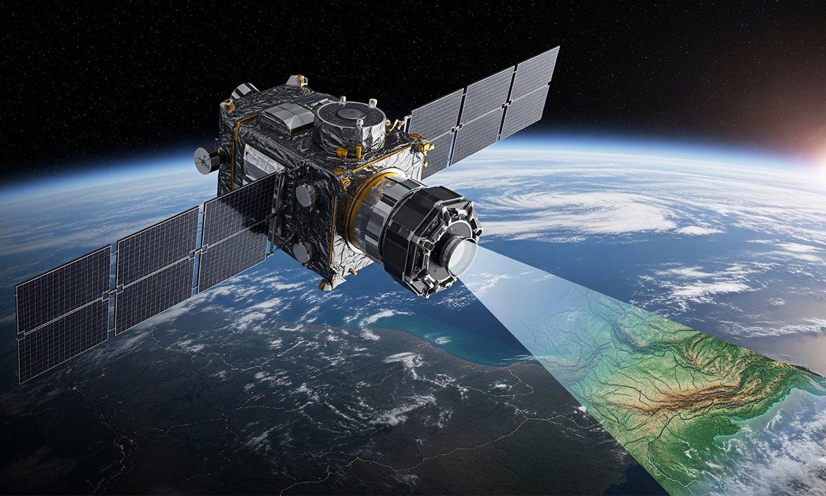
Google DeepMind has unveiled a groundbreaking artificial intelligence model named AlphaEarth Foundations, designed to enhance the mapping of Earth’s surface. This innovative geospatial AI model integrates satellite imagery and environmental data to provide a comprehensive view of the planet, aiding scientists and governments in making informed decisions related to land and sea management.
Satellites orbiting Earth collect vast amounts of data daily, but this information often exists in multiple formats and timestamps, complicating its integration. AlphaEarth Foundations functions as a “virtual satellite,” consolidating these diverse data sources into a coherent representation of the Earth’s surface. For instance, it can penetrate persistent cloud cover in Ecuador to accurately map agricultural plots at various growth stages and can effectively image the challenging terrain of Antarctica.
The AI model can detect changes in land use, including new construction, deforestation, and crop development, within 10-meter squares. It also demonstrates efficiency in data storage, using 16 times less space than comparable AI systems. To democratize access to this technology, Google will provide annual snapshots from 2017 to 2024 through a new Satellite Embedding dataset in Google Earth Engine. This dataset will encompass more than 1.4 trillion data points each year, ready for immediate application without requiring additional processing.
More than 50 organizations, including the United Nations’ Food and Agriculture Organization and Stanford University, have already begun testing the system. Notably, the Global Ecosystems Atlas is utilizing AlphaEarth Foundations to classify unmapped ecosystems, while Brazil’s environmental mapping group, MapBiomas, employs the tool to monitor changes in farmland and forest areas.
Despite its potential, experts caution that AlphaEarth Foundations relies heavily on high-quality satellite data. According to a blog post by GoGeomatics Canada, while the model excels in filling gaps in incomplete data, poor-quality inputs can lead to misinterpretations in critical scenarios.
Functionality and Applications of AlphaEarth Foundations
The functionality of AlphaEarth Foundations lies in its ability to merge various satellite and environmental data into a unified, detailed image of Earth. It effectively stitches together thousands of data pieces, akin to assembling a complex puzzle from numerous sources. The system incorporates various public datasets, including:
– Optical satellite images, similar to those found on Google Earth
– Radar scans capable of penetrating cloud cover
– 3D laser mapping
– Climate and environmental data, such as temperature and precipitation
– Elevation maps and gravity measurements
– Descriptive locational information
By treating images from the same location over time as sequential frames, the AI model can analyze changes across seasons and years. This capability allows it to track developments such as crop cycles, deforestation, and urban expansion.
Google describes the model’s output as a “64-dimensional representation” for each 10-meter square, encompassing not just geography but also appearance, environment, and behavior over time. Christopher Seeger, a professor of landscape architecture and geospatial technology at Iowa State University, remarked on the significance of achieving such detail, stating, “What is interesting is that they’re able to get down to 10-by-10 meter squares, which is phenomenal. It’s going to be great for decision makers.”
The introduction of AlphaEarth Foundations marks a significant advancement in Earth mapping technology, enabling scientists to create detailed, consistent maps on demand without depending solely on individual satellite passes. The model has the potential to support a range of applications, from monitoring wildfires and tracking water levels to facilitating urban growth analysis.
Looking ahead, Google plans to explore integrating the capabilities of AlphaEarth Foundations with its Gemini multimodal model, which could further enhance the system’s potential for varied applications. This development represents a considerable step forward in the realm of geospatial data and its uses in environmental management and planning.