


Researchers at the State University of Campinas in Brazil have developed an innovative technique that could significantly enhance our understanding of the Martian landscape. This method measures the forces acting on individual grains of sand, allowing scientists to uncover how wind has shaped the surface of Mars over time. The findings, published on August 1, 2023, in the journal Geophysical Research Letters, combine laboratory experiments, computer simulations, and artificial intelligence (AI) to create detailed force maps of sand dunes.
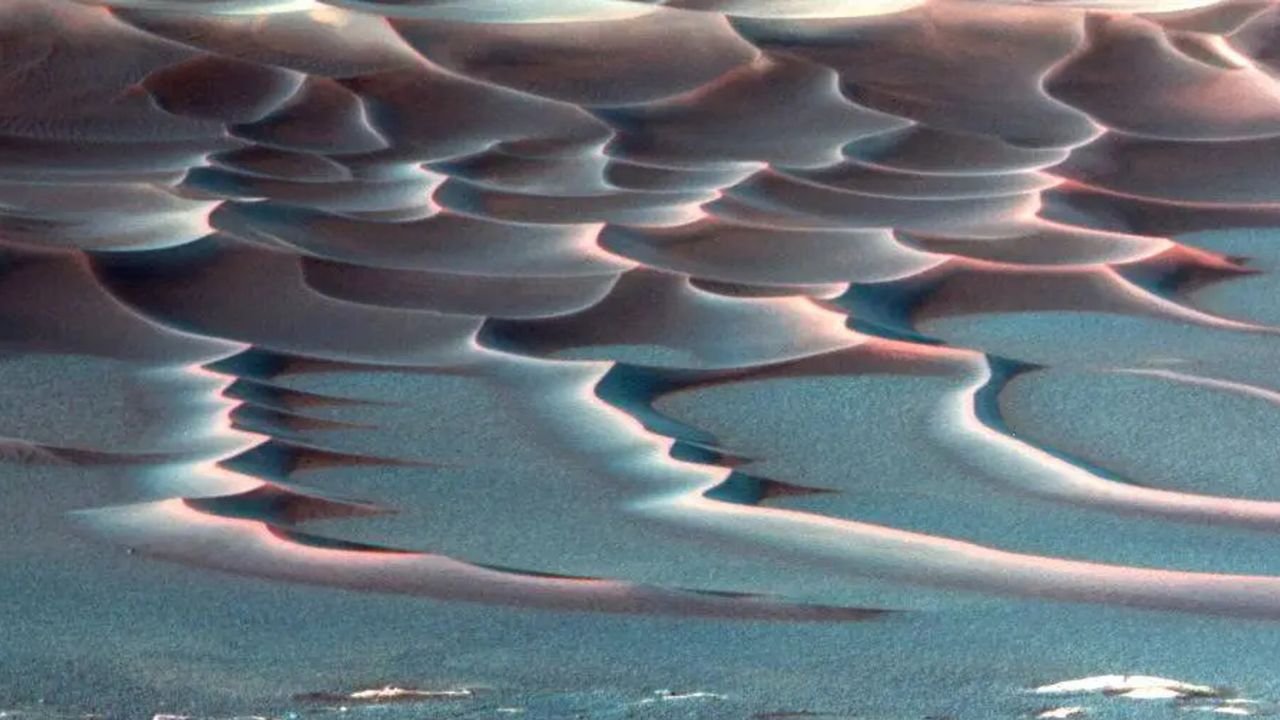
The team focused on understanding the dynamics of crescent-shaped barchan dunes, which form wherever wind or water interacts with loose sand. These types of dunes exist not only on Mars but also in deserts and seabeds on Earth. Traditionally, tracking the movement of dunes has provided insights into prevailing winds and environmental conditions. However, until now, it has been nearly impossible to measure the forces that drive each grain’s motion.
According to the researchers, measuring the forces acting on individual grains would require placing tiny accelerometers on each grain, a technology that is not currently available. To overcome this obstacle, the team created miniature underwater dunes in a laboratory environment and conducted comprehensive 3D simulations to calculate the exact forces at play.
The researchers then trained a convolutional neural network, a type of AI known for its image recognition capabilities, to connect images of dunes with their corresponding force maps derived from simulations. Once trained, the AI demonstrated an impressive ability to infer the distribution of forces directly from visual data. When applied to new images, the AI accurately predicted the forces involved, even in dune formations it had not encountered before.
Renato Miotto, a postdoctoral researcher and lead author of the study, remarked, “Any granular system that can be seen in an image — whether ice, salt, or synthetic particles — can be analyzed as long as there’s a simulation capable of accurately reproducing the behavior of the material.” This capability to extract detailed physical information from images has vast implications for various fields.
On Earth, the methodology could aid engineers in predicting coastal erosion, river sediment transport, and the behavior of granular materials in industrial processes. The technique also holds promise for studying other celestial bodies, including Mars, where dunes evolve according to the same fundamental physics observed on Earth.
Erick Franklin, professor and co-author of the study, explained, “In the case of Mars, it’s possible to infer, from widely available images, the intensity of winds in the past and the evolution of dunes in the future.” This groundbreaking method provides a novel lens through which to examine the atmospheric history and surface evolution of the Red Planet.
By revealing the intricate details of how wind has influenced Martian dunes, this research not only advances our understanding of Mars but also enhances the potential for future exploration and study of planetary environments. With continued advancements in technology and methodology, the mysteries of Mars may gradually unfold, one grain of sand at a time.